Surveying
Land Surveying Services
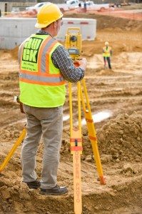
 Alley, Williams, Carmen and King offers a full range of Land Surveying services using both GPS and conventional methods. AWCK’s field crews collect the data needed to complete projects in a timely manner. Our GPS surveying utilizes RTK (Real Time Kinematic) network positioning based on the North Carolina VRS (Virtual Reference Station) network. AWCK also provides mapping grade surveying for GIS applications using Terrasync and Arcview for mapping. Our conventional surveying equipment includes the latest Total Stations and Data Collectors operated by our experienced field crews.


